


Historische atlas van Antwerpen: Stad van droom en daad
Tim Soens, Ilja van Damme, Hilde Greefs, Iason Jongepier
GIStorical Antwerp & Thoth, 2022
€32,95
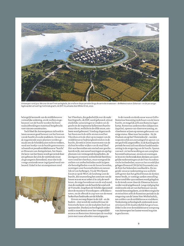
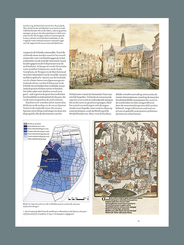
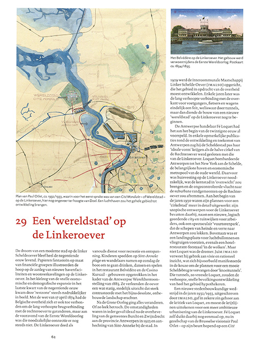
Antwerp developed into a hub for European trade in the fifteenth and sixteenth centuries. This went hand in hand with major urban development ambitions that could only be partially realized. Around 1700 the city even shrank within its walls. In the nineteenth and twentieth centuries, the port revived and industrialization provided new growth. New harbor docks were built, the inner city was modernized and the suburbs were integrated into the urban fabric. Once again, the plans, such as those for the Left Bank, turned out to be larger than the actual implementation.
Using maps, prints and photos, the Historical Atlas of Antwerp offers insight into the development of urban space as it was drawn up by government authorities, artists, planners and residents. Unsuspected spatial connections and patterns are revealed through innovative digital GIS analyses.
The reader is taken from the origin of the castle, the old heart of the city, through the sixteenth-century heyday,into the increasingly rapid transformations in the post-war period. The construction of churches, quays and docks, trading houses, squares and city palaces is dissected into stories that tell as much about the desired as about the realized city, and that determine the further development of Antwerp in the twenty-first century. IN DUTCH!
ISBN: 9789068688344

